 |
|||||||||
|
|||||||||||||||||||
| news index | Three-month
deadline for final access map check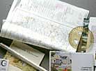 Owners
and occupiers of land are being urged to take the final opportunity
to check the provisional map for the northern region of England
which the Countryside Agency considers to be access land under
the Countryside and Rights of Way Act 2000. Owners
and occupiers of land are being urged to take the final opportunity
to check the provisional map for the northern region of England
which the Countryside Agency considers to be access land under
the Countryside and Rights of Way Act 2000. The map, which was published on Tuesday (August 19) is the second stage in a three-part process to fix the location of common land and open country - mountain, moor, heath and down - in nearly all of Cumbria, parts of Northumberland, County Durham and North Yorkshire, and a small part of north-east Lancashire. NFU North West regional director Terry Abbott said: “The publication of the provisional map also marks the start of a three month appeal period. It is essential for farmers who made comments about the first map to check what alterations have been made. “ And those farmers who may have felt unaffected by the original proposals should also check the latest map to see if their situation has been changed in any way”. Sue Harrison, the CLA's deputy regional director added: "The Countryside Agency has amended the map in light of the thousands of comments they received. This the last chance you will have before the final map is published and you should check to see if any of your land has been included or taken away since the last version". The Countryside Agency published a draft map that identified registered common land and open country and made those maps available for public consultation. As a result of that consultation, many amendments are likely to have been made. The Act will not come into effect until a third, ‘conclusive’ map has been published and the Environment Secretary has made a commencement order. Until then there will be no public right of access to the land. The Countryside Agency says now the provisional map is published, people with a legal interest in the land, such as landowners, tenants and holders of common or sporting rights, a licence or agreement, have three months to appeal to the Planning Inspectorate, who run the independent appeals process, if they think the provisional map incorrectly identifies a site as registered common land or open country. The provisional map for the upper northwest is on public view at local authority offices, main libraries and by appointment at the Countryside Agency in Manchester. Local parish councils will also have copies of the map. Upper North West (area 4) covers part of Cumbria (excluding most of the area around Carlisle north of the A595/A69 and a small area south of the A65), part of Northumberland (south of the A69), part of County Durham (including Teesdale, Wear Valley and Derwentside), part of North Yorkshire (including Harrogate, Richmond and the part of Craven district that is within the boundary of the Yorkshire Dales National Park) and a small part of Lancashire north of the A65. |
||||||||||||||||||

|
|
||||||||||||||||||
| home | agri-services | pedigree
pen | news | dairy | beef | machinery property | organisations | site map |
|||||||||||||||||||